Tropical Depression Chantal was bringing flooding rains and multiple tornadoes to central North Carolina over Sunday night, prompting Orange and Moore counties to declare states of emergencies.
The big picture: Chantal was threatening communities inland after making landfall as a tropical storm along the coast of the Carolinas on Sunday morning, with the National Weather Service noting that thunderstorms associated with the depression were producing “very heavy rainfall” across central and eastern N.C. and into southern Virginia.
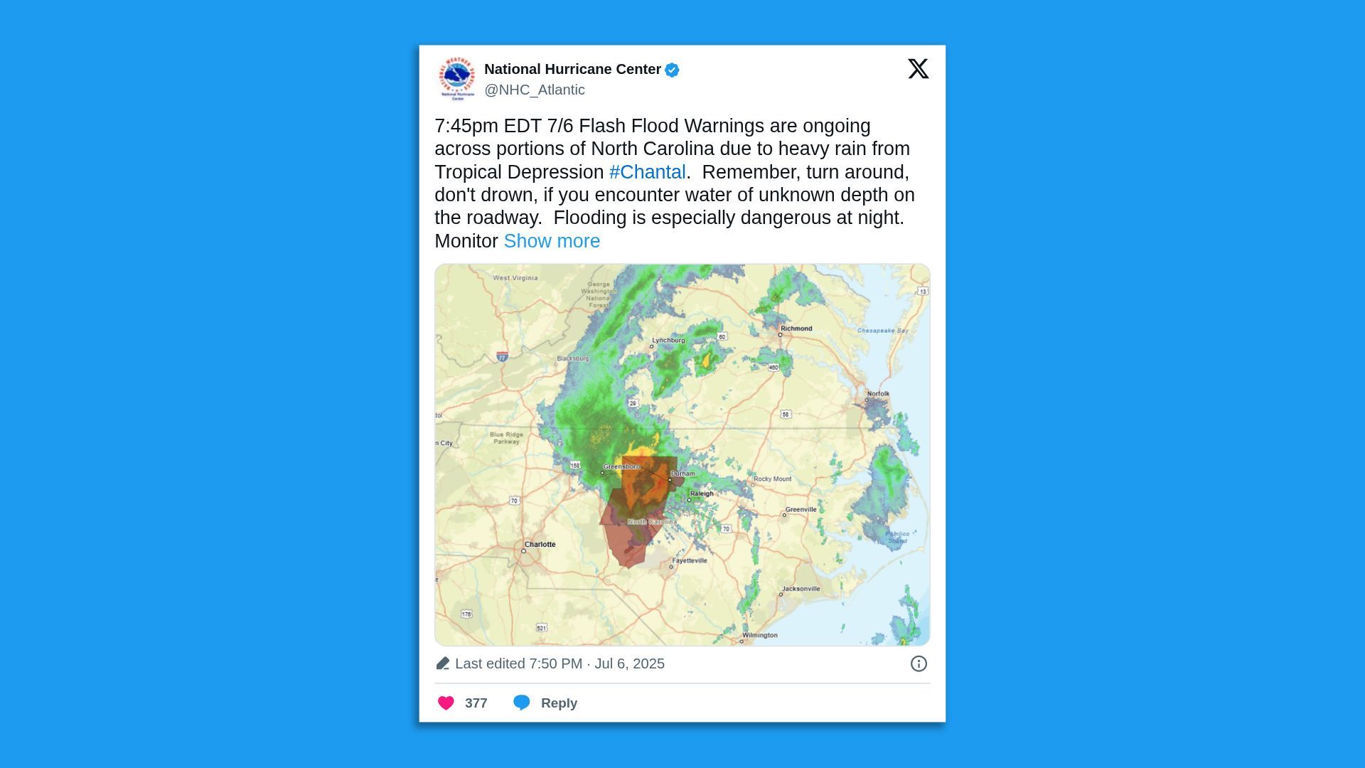
Threat level: “A Slight Risk of Excessive Rainfall remains in effect for this region as very heavy rainfall totals of 4-6″, possibly higher, will bring the threat of scattered instances of flash flooding,” per the NWS’ forecast discussion.
- Chantal “brought wind gusts of up to 56 mph and over 5 inches of rain to portions of the coastal Carolinas” Sunday morning after forming as a tropical storm a day earlier, the NWS’ Wilmington, N.C., office noted on X.
- “A pre-dawn tornado in Wilmington produced winds estimated near 70 mph,” the office said.
Zoom in: Moore and Orange counties declared states of emergency due to the storm’s flooding rains on Sunday.
- A voluntary evacuation order was issued for some communities “due to the possibility of Lake Michael Dam failure,” Orange County Emergency Services said on Facebook.
- “Additional rainfall is expected overnight. Please stay off the roads,” the county said in another Facebook post.
- The Town of Southern Pines in Moore County said in an online post that estimates from the “intense, fast-moving rainfall” were as high as 7-8″, but the town’s infrastructure had “performed exceptionally well with little to no impact” on services.
By the numbers: Nearly 37,000 customers were without power in North Carolina on Monday morning, the vast majority in Orange County, per utility tracker poweroutage.us.
Context: Studies show climate change is altering the frequency and severity of extreme precipitation events that lead to flooding.
What’s next: “Chantal is expected to continue northward Monday bringing thunderstorm chances deeper into the southern Mid-Atlantic, where heavy downpours and isolated flash flooding can be expected,” per the NWS.
- “The system should dissipate by Tuesday but remnant moisture may continue to lead to heavier showers throughout the region.”
Go deeper: Texas tragedy foretells future for warming climate, scientists say