One of Texas’ most popular rivers flooded over the weekend and contributed to Texas’ catastrophic flooding that claimed over 80 lives, including two dozen children at Camp Mystic.
Here’s what to know about the layout of the river and the role it played in one of the state’s deadliest flash floods in modern history.
People are also reading: Here’s why the Texas Hill Country flood was much worse than anyone ever expected
Where is the Guadalupe River in Texas? Where does the Guadalupe River start and finish?
The Guadalupe River stretches across Central Texas and down to south-central Texas. Starting with “its North and South Forks in Kerr County, the spring-fed stream flows eastward into Kendall and Comal Counties where it then turns and flows south to the Gulf of Mexico,” the Texas Parks and Wildlife Department reports. The length of the river is about 250 miles.
A major river system and the fourth-largest river basin entirely within Texas, the Guadalupe River Basin flows from the Texas Hill Country to San Antonio Bay.
Where is the Texas flooding happening?
How high did the Guadalupe River rise?
At one point in the early hours of Friday, state officials reported the Guadalupe River had risen 26 feet in just 45 minutes.
Although the U.S. Geological Survey has recorded the river flooding more than a dozen times since 1978, the Independence Day 2025 flood is among the worst in its history. The USGS recorded the Guadalupe River’s discharge peaking at a staggering 111,000 cubit feet per second at 7:30 p.m. on Friday.
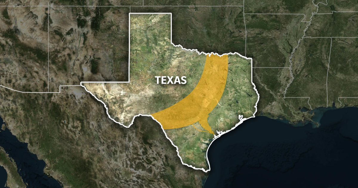
What is ‘Flash Flood Alley’?
The Guadalupe River and its surrounding areas in Texas Hill Country have historically been prone to flash flooding, earning the nickname “Flash Flood Alley.” This area is particularly hazardous, as river levels increased rapidly at the end of last week and over the weekend.
Flash Flood Alley is a curved-shaped region about 300 miles long and 50 miles wide in central and south-central Texas, extending from north of Dallas to southwest of San Antonio. Its location, weather patterns and geology often combine to create devastating floods.
Those factors include:
- Heavy rain: The region lies between cold, dry air from the north and wet, warm air from the Gulf. The air masses converge and create intense rainstorms.
- Rocky soil: Limestone in the area prevents rainwater from soaking into the ground. Instead, the water rushes into valleys, Texas Public Radio says.
- Steep terrain: The Balcones Escarpment is a series of fault lines in Central Texas. It creates a series of cliffs and hilly terrain.
— USA TODAY contributed to this report.