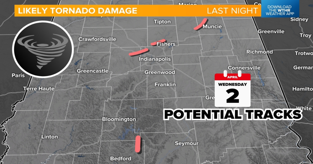
INDIANA, USA — Tornadoes touched down across central Indiana Wednesday evening, some in very populated areas like Hendricks and Hamilton counties.
Tap HERE to track our next round of rain and storms developing to the west with our interactive radar.
We waiting for the National Weather Service to survey the damage areas and to confirm whether or not the debris is from straight line winds or a tornado. If it was a tornado, they will estimate the wind speeds and provide a damage rating.
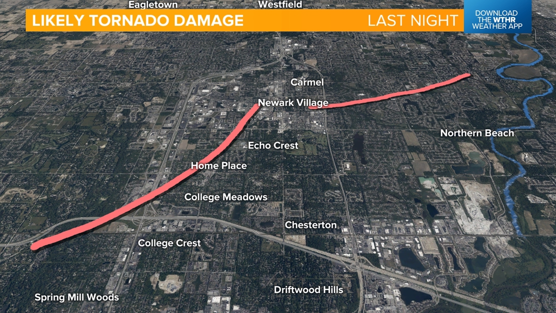
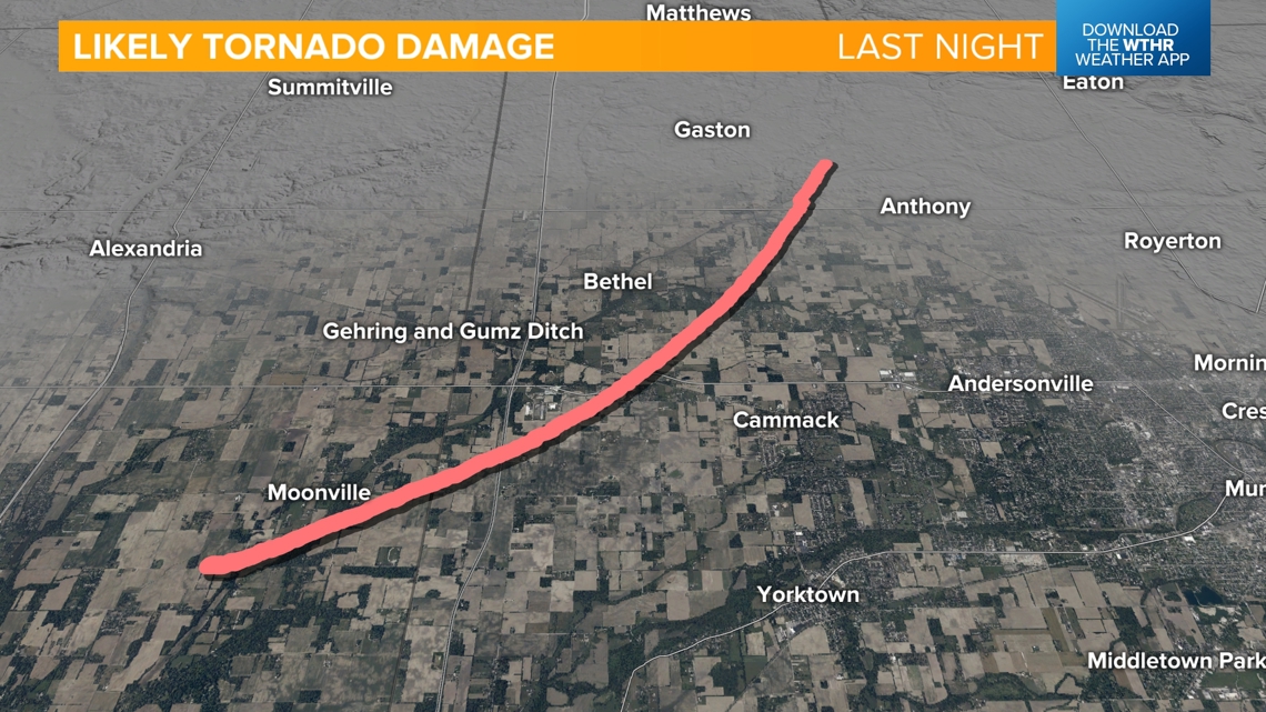
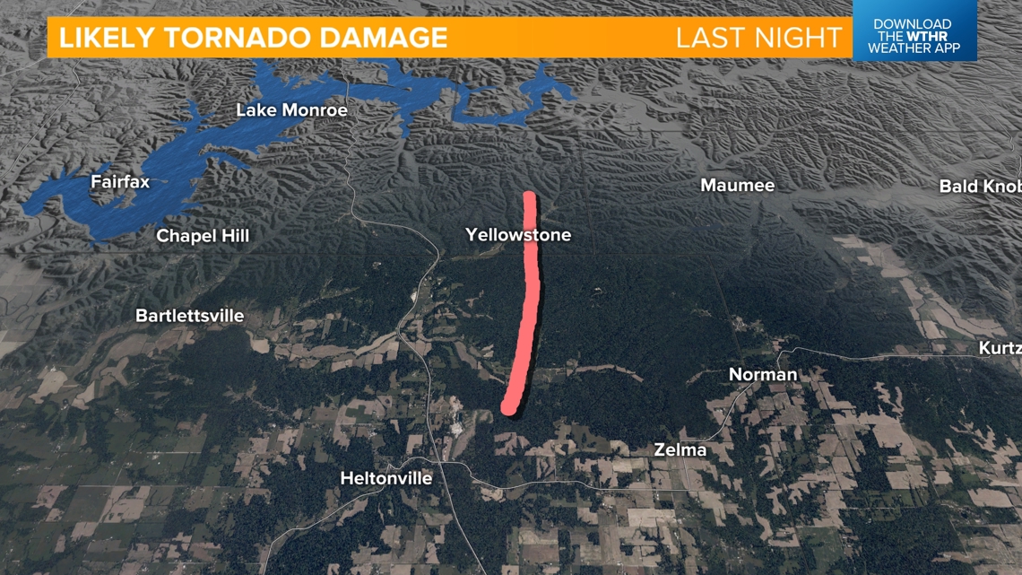
This is a very early look at the map to see where we may have had tornado touchdowns. This is not final.
The red lines show where we saw debris in the radar beam, plus received damage reports. These lines will be adjusted, connected, split, or even removed once we receive confirmations from the NWS.

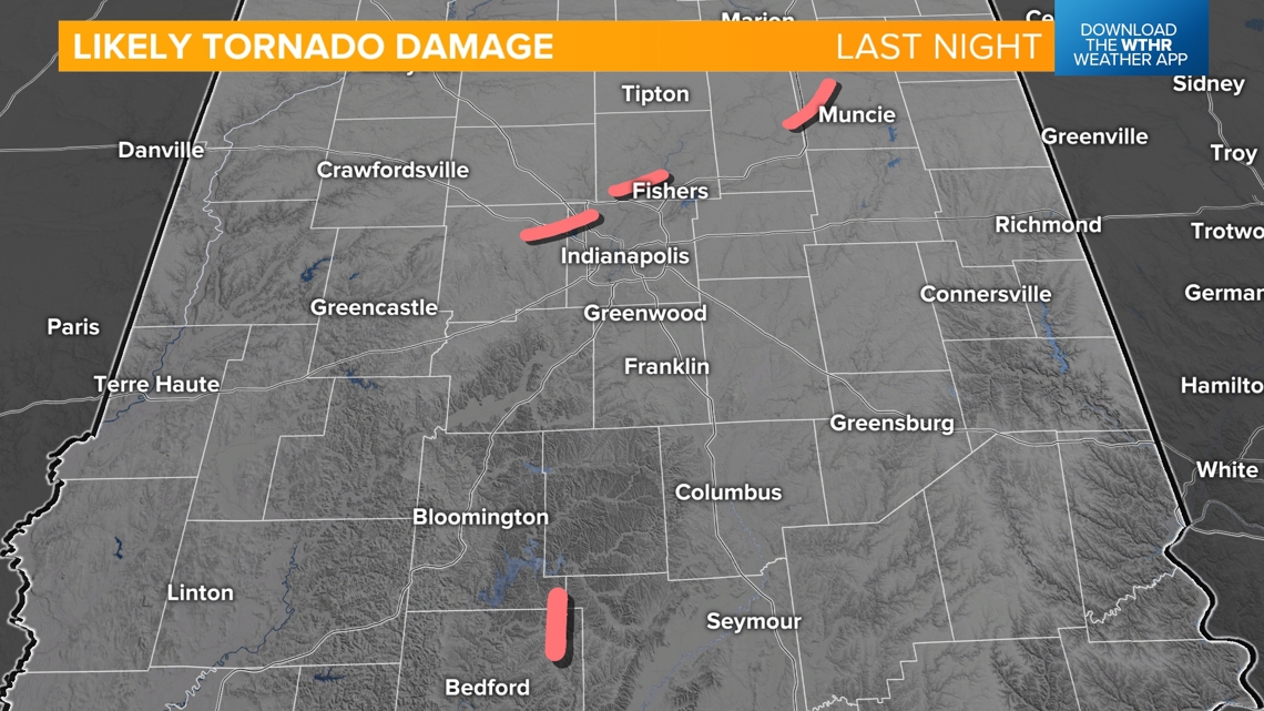
This is a very early, preliminary look at potential paths.
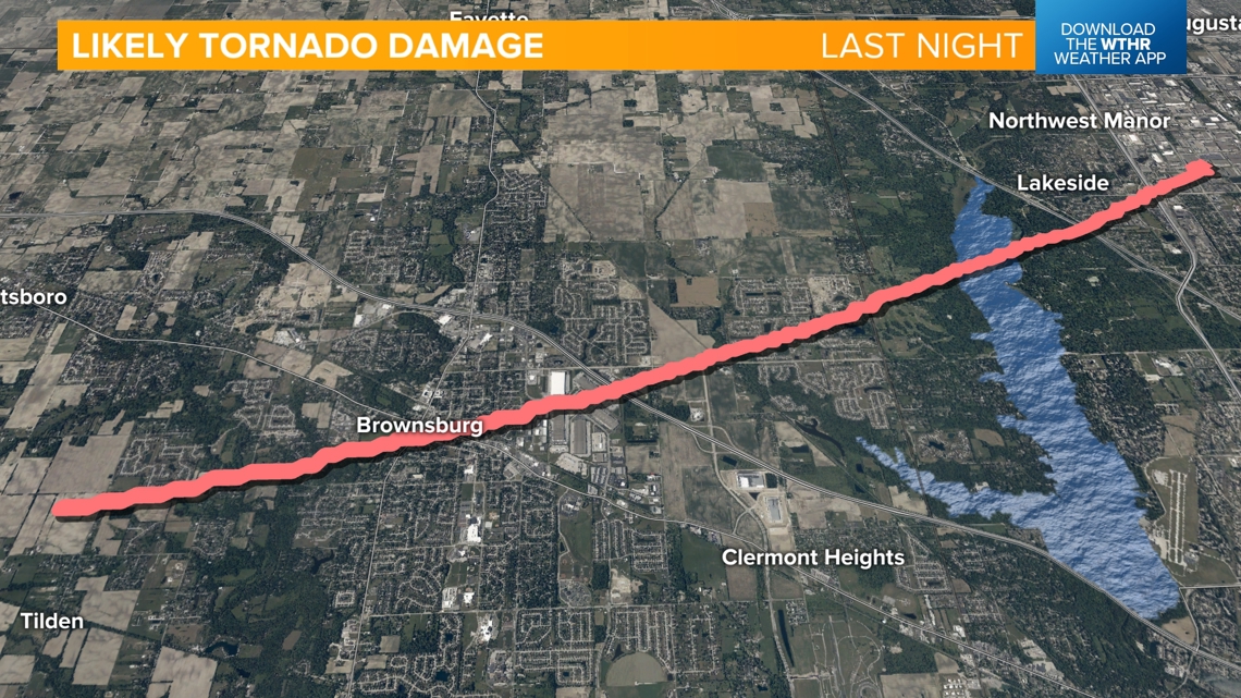
We have damage reports near and east of downtown Brownsburg. We believe a wind storm in Danville helped spin up this tornado. There is damage at the warehouses along Northfield Drive. The likely tornado probably crossed I-74 headed toward Raceway Road and Eagle Creek. We have damage in the subdivisions along Raceway Road.

We also saved some radar imagery of the rotation and wind shear of this storm. Look at the deep red and yellow color highlighting the turbulent air we believe to have been spinning into a possible tornado.

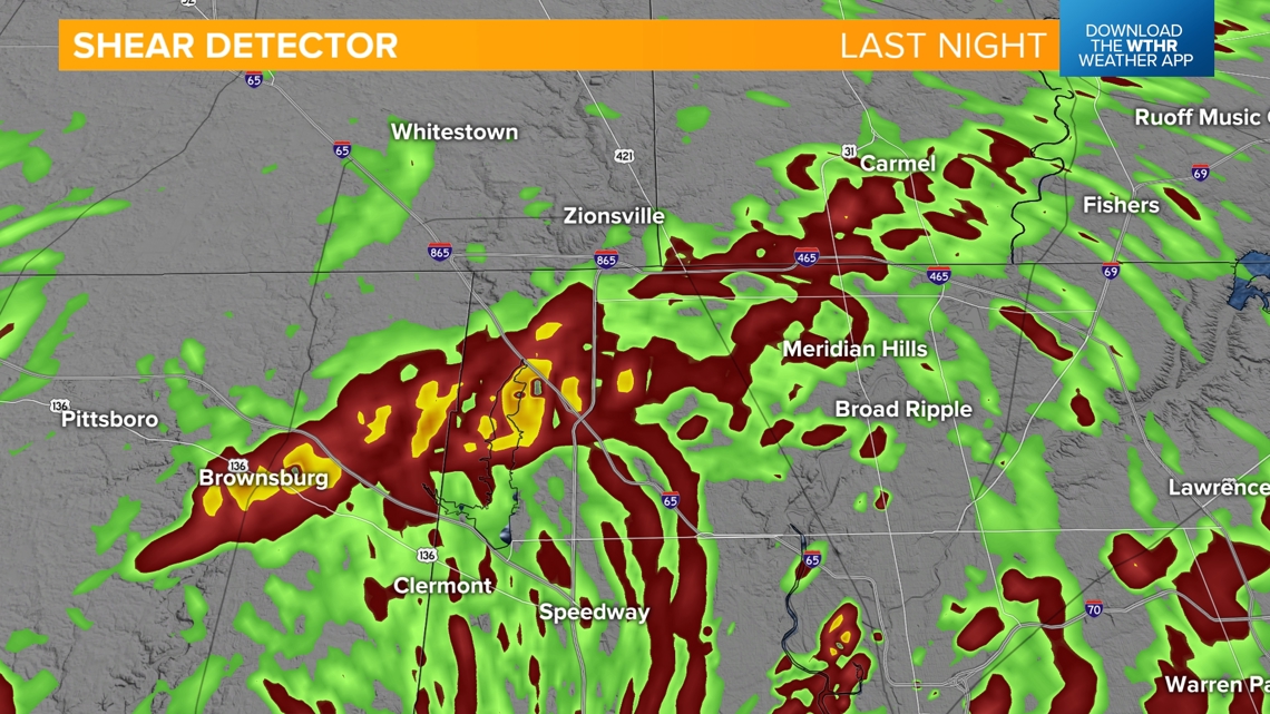
Reports are sparse in the northwest corner of Marion County. We think the rotation possibly created a new tornado around the Carmel area. We have damage near the Ritron building, the Antique Mall and the Carmel Ice Skadium.
We have no idea right now if two separate tornadoes touched down around Carmel or if there were multiple. We saw the debris ball waver in intensity as it headed east toward Noblesville.

Another debris ball signature developed northeast of Anderson near Moonville. It then moved northeast into Delaware County. This stayed a handful of miles northwest of Muncie. We’ve had some damage reports around Cammack and Gaston.

There was a very brief debris ball near Heltonville and Yellowstone, Indiana. Reports are sparse in this area.

There may be more tornadoes confirmed than the areas we have mentioned. It was a busy night last night.
Below are all the warnings (severe thunderstorm, tornado, and flash flood) issued across Indiana. We are waking up to water-damaged roads, trees down, power lines down, and over 100,000 power outages as of 6 a.m.

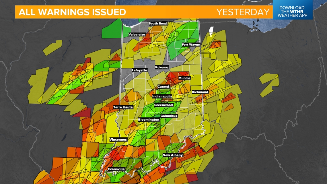
In fact we have had over 20 school delays and closings in central Indiana.
Once tornadoes are confirmed by the NWS, we will pass along that information.
-13News Meteorologist Matt Standridge
