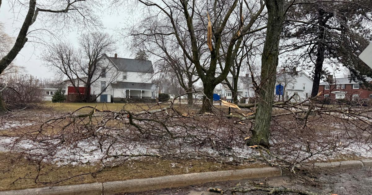
Hundreds of thousands of people are without power and damage is being reported to homes and cars as storms and severe weather rake across parts of the Midwest and South.
The storms are part of a potential severe weather outbreak that threatens states including Oklahoma, Missouri, Indiana, Arkansas and Kentucky. Cities in the possible path include St. Louis, Dallas, Indianapolis, Nashville and New Orleans.
“This weekend’s severe threat is being driven by a classic spring severe weather setup,” weather.com digital meteorologist Sara Tonks says. “A sharp southward plunge in the jet stream is moving eastward, providing ample wind shear to support the development of severe weather along a cold front and strong low-pressure system.”
Here’s what’s happening now:
(08:11 p.m. EDT) Michigan College Campus Issues Shelter In Place Order
Students and other personnel at Grand Valley State University in Grand Rapids were told to shelter in place this evening when the area was placed under a tornado warning.
The all clear was given about an hour later.
(07:58 p.m. EDT) Why Wear A Helmet in A Tornado Warning?
“You definitely can lower your risk of these severe injuries by wearing a helmet,” emergency room physician Dr. Chris Davlantes told us in a recent interview. “It’s one of these critical but very much overlooked safety features or measures that people don’t think about.”
The reason? Head injuries are the No. 1 cause of death from tornadoes.
You can read more here about why helmets are an important part of your emergency preparedness kit.
(07:40 p.m. EDT) Freezing Rain, Power Outages In Michigan
A tree limb is seen on the ground, covered in ice.
Freezing rain knocked down trees and power lines across parts of Michigan, contributing to more than 275,000 power outages currently being reported by PowerOutage.us. Most are across the northern part of the state.
Jesika Fox told the Associated Press she and her husband drove more than 40 minutes from their home in Alpena, Michigan, to find fuel for a generator after they lost power last night.
“We just passed a veterinary clinic. The entire front corner of the building was taken out by a tree,” Fox said.
(07:31 p.m. EDT) Wet Mess At MLB Game Between White Sox And Angels
A person sweeps water off of plastic over a red baseball diamond.
From the Associated Press:
A fast-moving storm that caused a delay during Sunday’s Angels-White Sox game created a headache for the grounds crew at Rate Field.
It began to pour when a storm rolled over the ballpark with the game tied at 2 in the bottom of the seventh inning. The crew rushed out to the tarp, but the workers weren’t able to pull it over the entire infield and the area around the first base line was exposed to the weather.
The crew used a patchwork of smaller tarps to cover as much of the area as it could. When the rain stopped, the crew began to work on the infield with bags of drying material.
The game resumed after a delay of nearly three hours.
(07:20 p.m. EDT) Tornado Watch Vs. Tornado Warning – Know The Difference
A tornado watch or severe thunderstorm watch is issued when conditions are favorable for severe weather. It should be considered a heads-up to pay close attention to your forecast and weather alerts, and have a plan to shelter if needed.
A tornado warning or severe thunderstorm warning happens when either of those events are taking place. A warning means you need to take action immediately, including sheltering in a safe place.
(07:08 p.m. EDT) Wind Gust Over 95 MPH Reported In Michigan
More from Tonks:
A weather station at the Jackson County-Reynolds Field Airport reported a thunderstorm wind gust of 96 mph near Jackson, Michigan. 96 mph sustained winds in a tropical cyclone would qualify as a Category 2 hurricane.
Earlier today, downed trees and wind damage were reported after a wind gust of 85 mph was recorded in the southeast Kansas community of Baxter Springs. A wind gust of 79 mph was measured in Joplin, Missouri, and hail up to 2.5 inches in diameter was reported Southwest of Oklahoma City.
(06:54 p.m. EDT) Hundreds Of Thousands Without Electricity
More than 103,000 power outages are being reported across Indiana, according to PowerOutage.us. Most are in the northern part of the state where severe weather caused damage to cars and homes in at least one community.
Each power outage represents a single account that can include multiple people in one household or building.
(06:45 p.m. EDT) Flooding Is An Issue, Too
Late this afternoon, a flash flood emergency was issued for parts of Harrison and Jackson counties in southern Mississippi. Storms threatened to dump up to 4 inches of rain on top of 1-2 inches that had already fallen.
(06:30 p.m. EDT) Trees Down, Homes Damaged In Mishawaka, Indiana
Photos posted to social media show damage in St. Joseph County, Indiana, about 78 miles southeast of Chicago.
The poster notes there are trees on houses and cars, and roofs are damaged.
(06:28 p.m. EDT) This Ramp Up In Severe Weather Is Right On Cue
“The ongoing tornado threat is standard for spring, especially as we creep closer to April, which kicks off the most active season for tornadoes in the United States of the year,” Tonks said. “The threat peaks this time of year because there is a perfect storm of severe weather ingredients. Leftover winter cold in Canada clashes with warm, moist air from the Gulf, fueling a strong jet stream and propelling intense low-pressure systems capable of packing highly variable weather conditions.”
Weather.com staff writer Jan Childs covers breaking news and features related to weather, space, climate change, the environment and everything in between.
