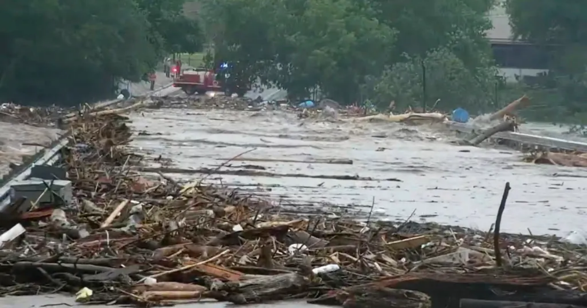
Parts of central Texas are in a state of emergency after an estimated 5-11 inches of rain prompted flash floods, forcing residents to evacuate on July 4.
Authorities in the city of Kerrville, about an hour northwest of San Antonio, confirmed at least six fatalities, according to the Kerr County Lead, and urged displaced people to gather at a local Walmart that’s being used as a reunification center. Police ordered people who live close to the Guadalupe River to evacuate to higher ground as the river swelled to its second-highest height on record.
Roads and streets are flooded, and “residents are encouraged to shelter in place and not attempt travel,” according to a statement from the Kerr County Sheriff’s Office. The National Weather Service in San Angelo also urged residents to stay off the roads.
“More than an entire summer’s worth of rain fell in some spots in just a few hours, quickly overwhelmed dry soils and created significant flash flooding,” CNN reported. “Central Texas is currently home to some of the worst drought in the United States and bone-dry soils flood very quickly.”
Flash floods are the most severe flood warning. In 2024, the National Weather Service recorded 91 flash flood emergencies, more than any other year since it started using that terminology in 2003.
The July 4th flooding in Texas is just the latest example of storms becoming more severe in the era of climate change. Strong and wetter storms are increasing in frequency. The warmer the atmosphere gets, the more water it’s able to hold, and subsequently dump over land, according to the National Resources Defense Council (NRDC). As ocean temperatures rise, glaciers melt, and sea levels rise, increasing the risk of coastal flooding. As the NRDC puts it, “While our warming world may not be the only or most direct cause of any given flood, it exacerbates many of the factors that increase flood risk.”