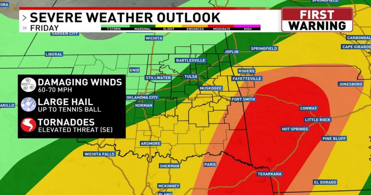
Most of Green Country will wake up on Friday morning with showers and t-storms, a few of which could be strong.
But the threat for severe weather will increase by the afternoon, especially in southeastern Green Country.
Here is a radar snapshot of 3pm Friday afternoon, during which time severe t-storms could be popping across southeastern Green Country, with very large hail and even tornadoes!
The tornado forecast for Friday shows where the greatest tornado risk will be.
The threat for severe storms with all hazards will continue into Friday evening, again focused on southeastern Green Country.
Heading into late Friday night and the first half of the weekend, the threat shifts to heavy rain and flooding.
The rain forecast through Saturday night shows greater than 5 inches of rain for southeastern Green Country.
Saturday morning will bring a good chance of rain and isolated t-storms. And that wind will be quite chilly!
The showers will linger into Saturday afternoon/evening, and so will the gusty north winds, putting quite a chill in the air with temperatures only topping out in the lower 50s.
Yes, you do see snow in western Oklahoma Saturday afternoon, and it will spread east into Saturday night.
An inch or two of snow is possible through Saturday night in western Oklahoma. Meantime, here in Green Country, we could see a trace of snow, but it will only stick to grassy and elevated surfaces.
Behind this storm, we’ve got some cold mornings headed our way! Check out the low temperature forecast.
