The 2025 Atlantic Hurricane season has been slow to start, but things are ramping up right on schedule.
Sunday, the National Hurricane Center had not one, not two, but three areas highlighted in the Atlantic for potential tropical development.
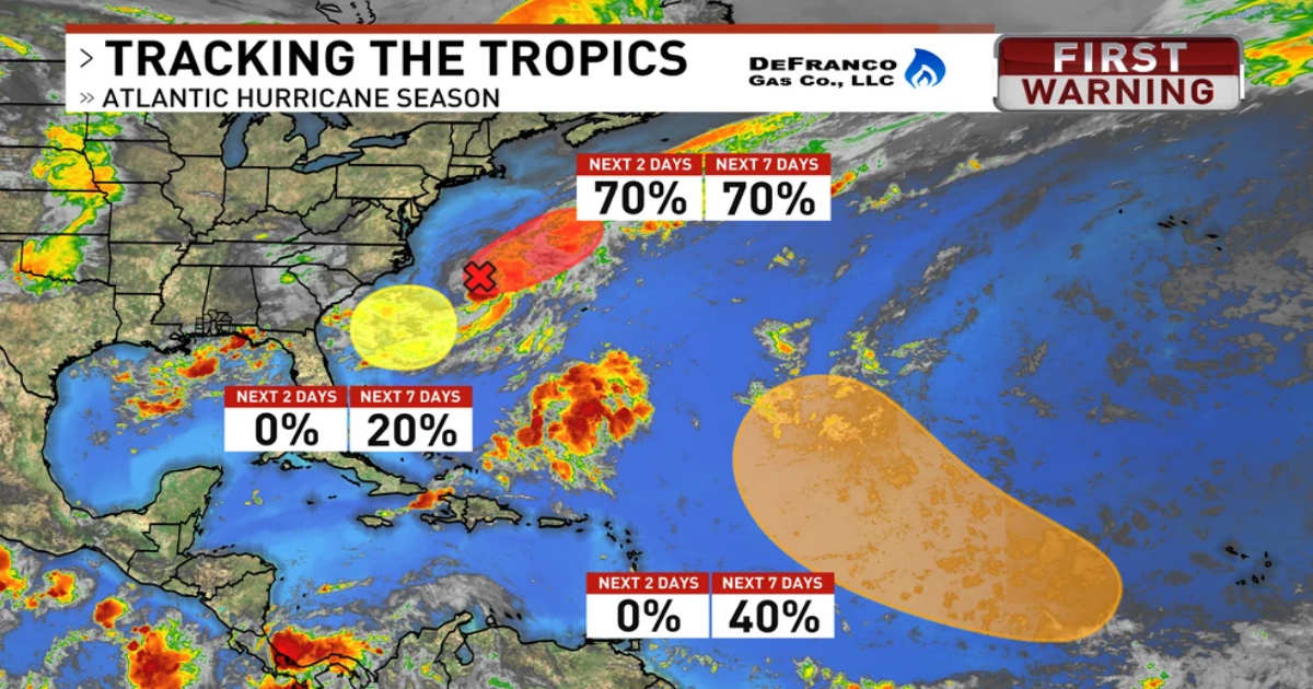
Off the coast of the Carolinas, a non-tropical area of low pressure developed over a frontal boundary as it stalled over warm waters. This is the same frontal system stalled over our local area, allowing for elevated rain chances this weekend.
Development chances of that system highlighted in red are high with a 70% over the next 2 and 7 days. It is moving northeastward and will not impact land. After Monday, it won’t stand much of a chance for any further development as it shifts.
The other area off the Atlantic coast highlighted in yellow is also associated with that stalled boundary, where another area of low pressure could form by midweek as it drifts northwest. This is located a few hundred miles southeast of the coast of the Carolinas. Development chances for that spot are low with 0% over the next two days and 20% over the next 7 days.
Way out in the central tropical Atlantic, a tropical wave is expected to move off the west coast of Africa over the next couple of days. The NHC says that environmental conditions could be favorable for some gradual development as it moves west-northwestward over the next week. Formation chances are medium with a 0% chance over the next 2 days and a 40% chance over the next 7 days.
Neither of these pose any threat to us here at home at this time. We will continue to keep an eye on things and keep you up to date on the latest.